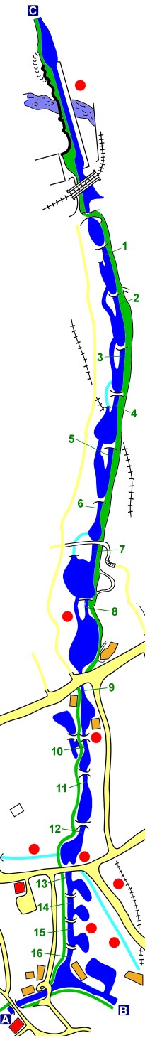


Find your way around Marple's Locks
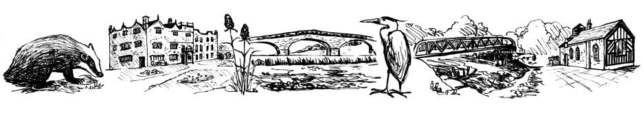
There are a number of web sites with "virtual tours" of the canals, including several covering the Peak Forest and Macclesfield Canals that run through Marple. Most of these follow a particular canal from end to end using a series of photographs taken along the route, accompanied by short captions. Rather than try to compete with these other sites on the same level, this tour attempts to complement them by just concentrating on the short but extremely attractive stretch of the canal as it passes through Marple.

Historic boats at Top Lock
The object of these pages is to focus on the history and points of interest along the one-and-a-half-mile stretch of the Peak Forest Canal as it travels from its Lower Level at Marple Aqueduct, rising up 209 feet through a flight of 16 locks, to reach the Upper Level at "Top Lock".

Horseboat Maria arrives at Marple Aqueduct
Marple's locks can be approached from two main directions by the narrow-boater. From the direction of Hyde, Woodley and Romiley on the Lower Level of the Peak Forest Canal (point C on the map), or from Bugsworth, Whaley Bridge, New Mills and Disley on the Upper Level (point B). Alternatively, the Upper Level can also be approached from the Macclesfield Canal (point A), which starts in Marple at its junction with the Peak Forest Canal.

Marple Wharf from Church Lane
Visitors travelling to Marple by car will find plenty of places to park a short distance from the canal. If you are hoping for refreshments during your visit, the car parks at the Ring O'Bells and Navigation Pubs are most conveniently situated and you will also enjoy a warm welcome and good beer. If you visit as a result of reading this, please mention it to the Landlord!
How to Navigate
You can navigate this virtual tour of Marple Locks using the menu down the righthand side, or by clicking Next or Prev on the bottom of each page to move linearly through the tour.
You can also navigate via "hotspots" on the map that appears down the righthand side of the screen on the introduction pages. Each of the locks is numbered (1 - 16) and clicking on the "hotspots" at these numbers will take you to the first page of information about that lock and the area in the immediate vicinity.
There are other "hotspots" on the map for points of interest, these are signified by red dots and can be clicked on in the same way. You can click on most areas of the canal, as well as some of the orange and red buildings shown on the map.
On many pages of this tour you will also find links to other pages of related information within the site and sometimes to other external web sites. Where necessary you should be able to use the back button of your browser to return if you get lost.
If you have any difficulties navigating this tour, please let me know and I'll do my best to resolve them.
The key to the colour coding on the map is as follows:
Blue - Canal
Light Blue - Former Canal Arms
Green - Towpath
Yellow - Footpaths
Orange - Buildings of Interest
Red Squares - Pubs
Red Spots - Points of Interest